A new bridge was apparently under consideration in 1840, and in 1853 plans for one were submitted by the county surveyor, James Trubshaw, who described the existing bridge as enjoying ‘the threefold distinction of being the longest, the most ancient, and the most inconvenient structure of its kind in the United Kingdom’. Nothing was done until 1859 when the Midland Railway Company, which wanted to lay tracks across the west end of the bridge, promoted an Act which authorised its demolition and the construction of a new bridge, forming a straight line between the existing ends and straddling Broad holme. The medieval bridge was gradually dismantled after the new bridge was opened in 1864.
Designed by the Midland Railway Company engineer, J.S.Crossely, the 1864 bridge was paid for by the Marquis of Anglesey, as lord of Burton manor, and the Midland and other railway companies. Under the 1859 Act responsibility for its maintenance passed from the Marquis to the counties of Staffordshire and Derbyshire, and it remained their joint responsibility until the Derbyshire side of the river was transferred to Staffordshire in 1894. The burden later passed to Burton corporation under an Act of 1896.
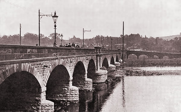
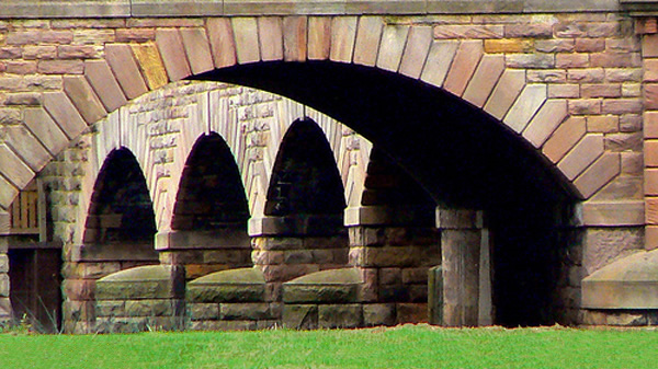
On the 23rd of February, 1863, the foundation stone of our present Trent Bridge was laid, and on the 22nd of June, 1864, a general holiday was proclaimed and the opening ceremony was performed by the Marquis of Anglesey at the head of a long and imposing procession, consisting of the yeomanry, the volunteers, principal inhabitants of the town, followed by many others. The bridge, unlike its predecessor, ran in a straight line across the river. It is 460 yards long, and consists of two causeways each five feet wide, and a roadway 20 feet wide. Each side of the bridge has a wall 3 feet high. There are 29 arches.
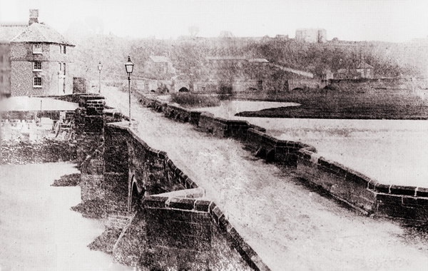
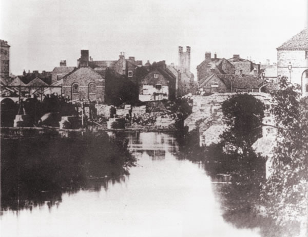
For a very brief period after the new bridge was completed, both bridges existed before the old bridge was demolished. The below photo shows BOTH bridges with the brand new one just completed and the old one to its right.
Originally 40 feet wide, including footways of five feet on either side of the road. The bridge was widened on its north side; this was completed in 1926.
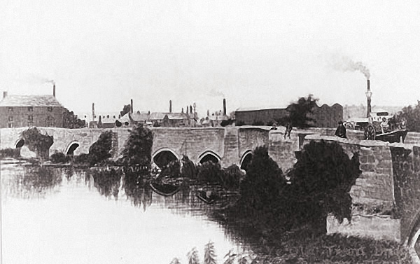
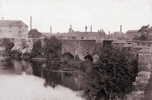
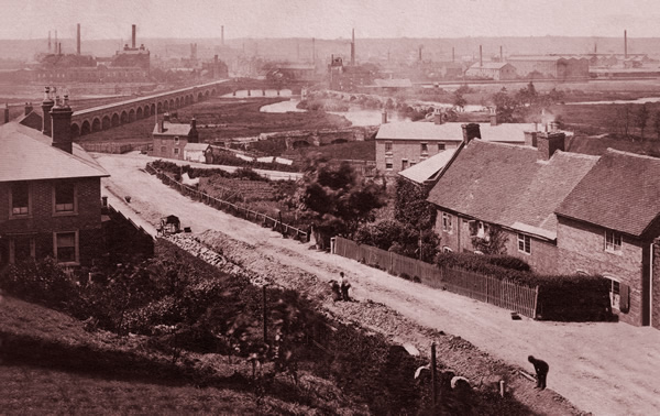
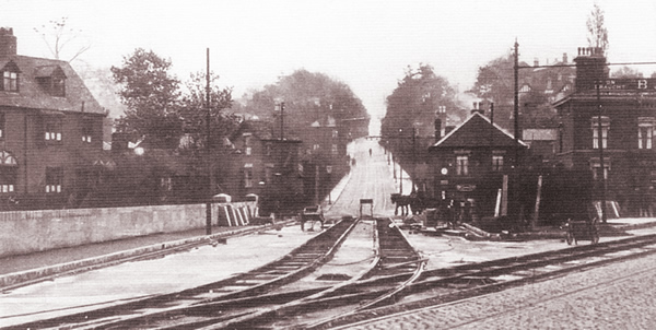
The bridge as shown above, shows Burton before the arrival of the tramway system. This photograph is also taken a few years before the Ferry Bridge was built making it the only option to the Stapenhill Ferry for crossing the river.
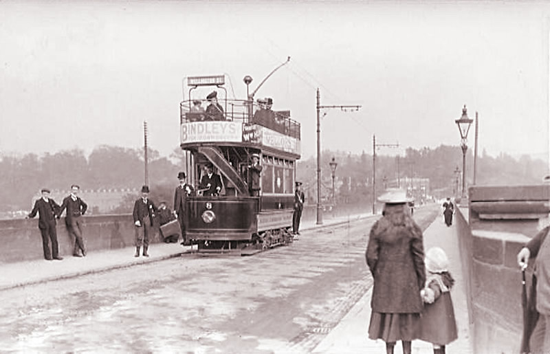
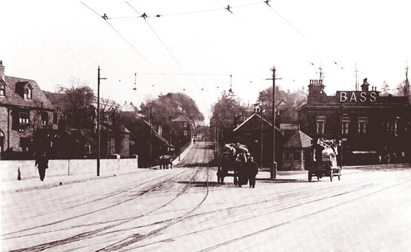
The trams arrived, making for this proud posed photo which later became the subject of a Burton postcard.
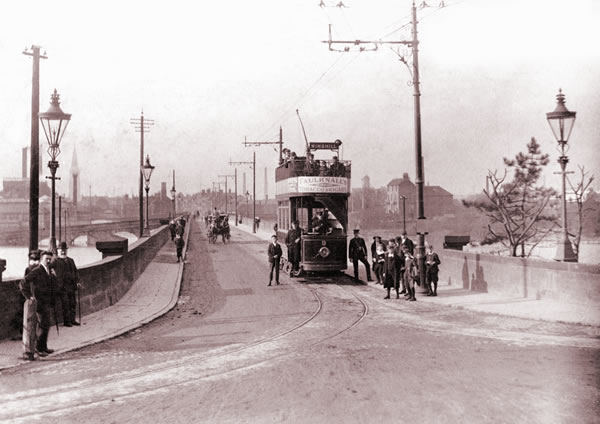
Notice that there is only one set of tracks. Winshill and Stapenhill trams had to co-ordinate in both directions so as not to end up in an embarassing head-to-head.
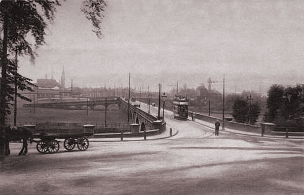
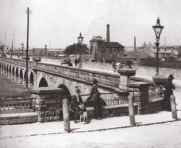
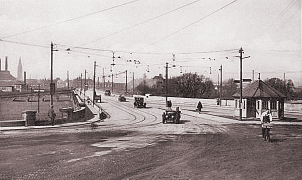
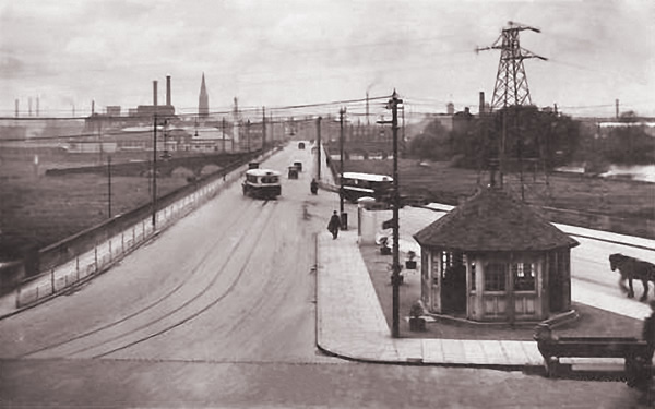
The above photo from 1908 shows what a tranquil place the ‘Swan Junction’ could be.
The tram is clearly approaching, but will it suddenly veer for Stapenhill or Winshill?
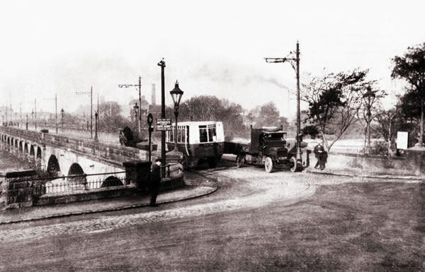
Before the bridge was widened and with the trams still in service, the increasing variety of modes of transport added to the confusion.
… and the bridge still remained much used by pedestrians.
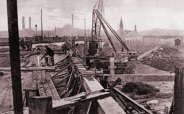
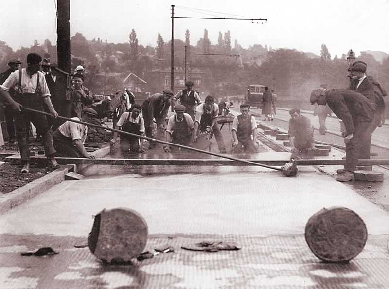
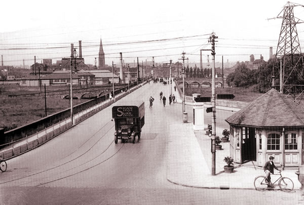
The much needed bridge widening was completed in 1926 making it twice as wide.
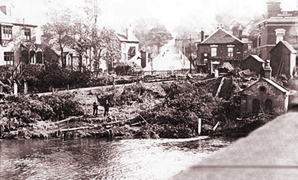
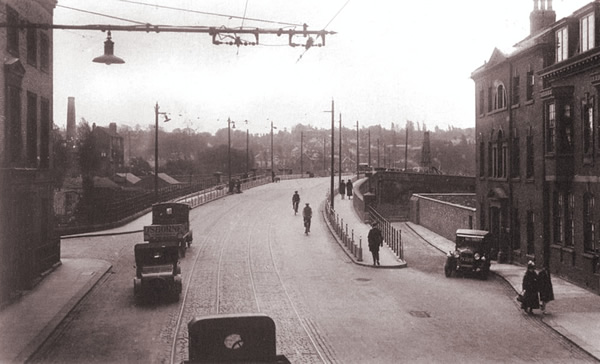
The above photo shows the view from the bridge looking up Bearwood Hill in 1910
Following a serious tram accident in 1919 where a tramcar ran out of control down Bearwood Hill over-turned after being de-railed at the sharp corner at the bottom, the Winshill end of the Trent Bridge was modified to provide a straight run.
For many years, Bearwood Hill up into Winshill felt like an extension of the bridge.
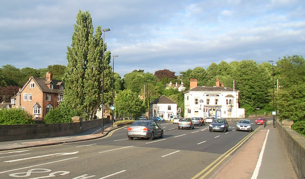
The widening is simply taken for granted now as today’s traffic simply flows into the Winshill filter lane. Trees and pedestrian area now effectively break up the view up Bearwood Hill making it feel like a much more minor route.
From bicycle delivery boy to boy racers in ‘modern’ sports cars – everyone enjoyed the space just after the widening. Some must have questioned whether it was really necessary.
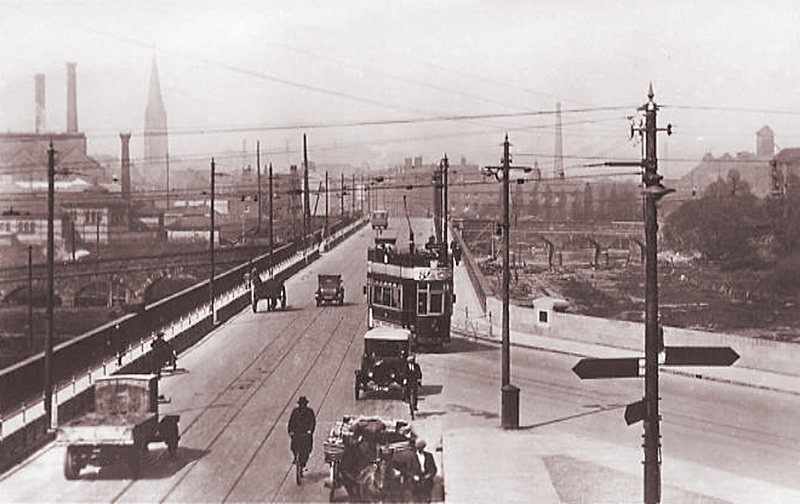
As time went on, it got busier and can be seen here being shared by bicycles, hand carts, horse drawn cars, motor cars, early lorries and electric trams.
Note also, the substancial barriers to protect foot pedestrians from such a commotion.
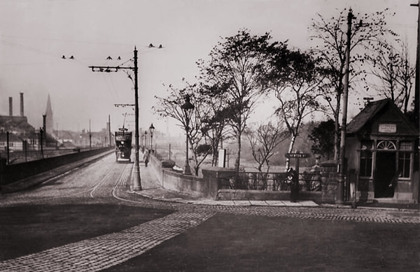
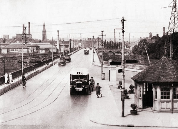
Even I can just about remember the distinctive shelter as a boy, and on rainy days, timing a dart across the road to catch an approaching number 3 or 4 bus up into Winshill, although everything around it was a little different. The overall impression is that this end of the Trent Bridge used to me much wider than currently which of course, it can’t have been.
By far the majority of photos of the Trent bridge are taken at the more picturesque Winshill end. Below is a much rarer photo from the Bridge Street end in taken in 1928 in the short period between the widening of the bridge in 1926 and closure of the Tramway system in 1929. It is still a very recognisable view.
The bridge remains one of Burton’s most characteristic features.
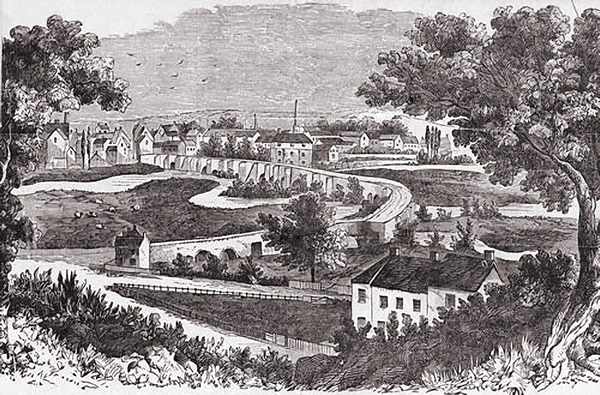 Burton from the East – 1800 (One of the most useful sources of the old bridge)
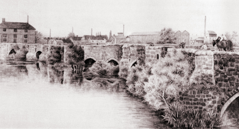 Trent Bridge at Burton – a scene from the early 1800s
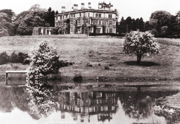
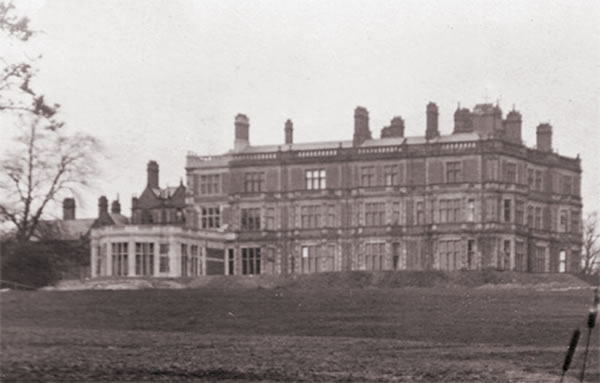
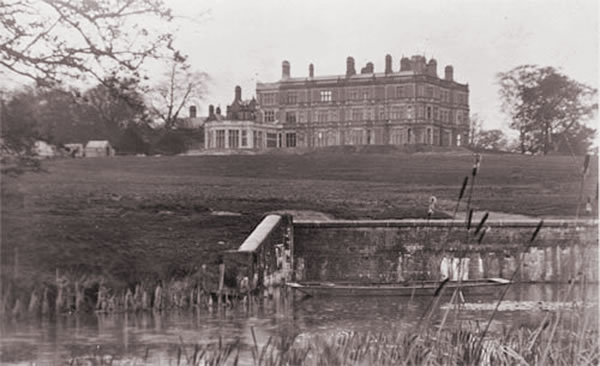
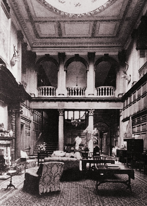
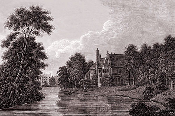 Burton Abbey – 1812, View of Manor House (Formerly the private residence of the Abbot.)
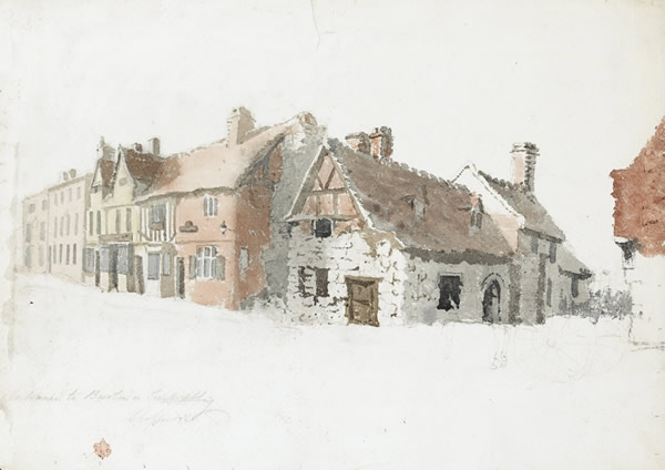 Burton Abbey Gates – 1830 (now Abbey Arcade, High Street)
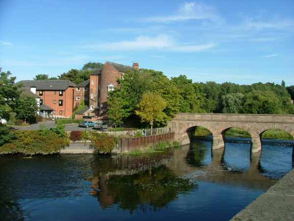
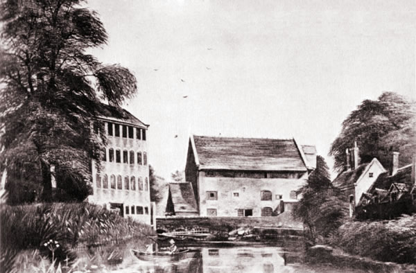 Peel Mill – 1830s (Still evident as apartments, Newton Road, Winshill)
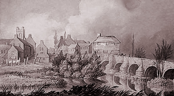 Old Trent Bridge – 1840, although anonymous, this picture provides terrific insight of the time
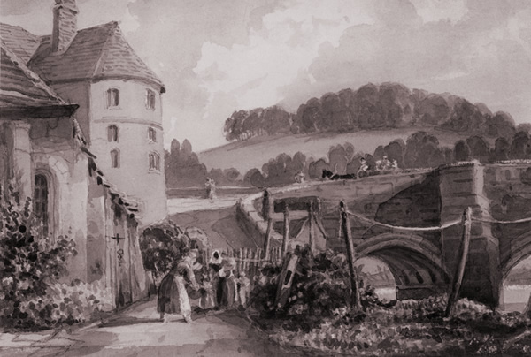
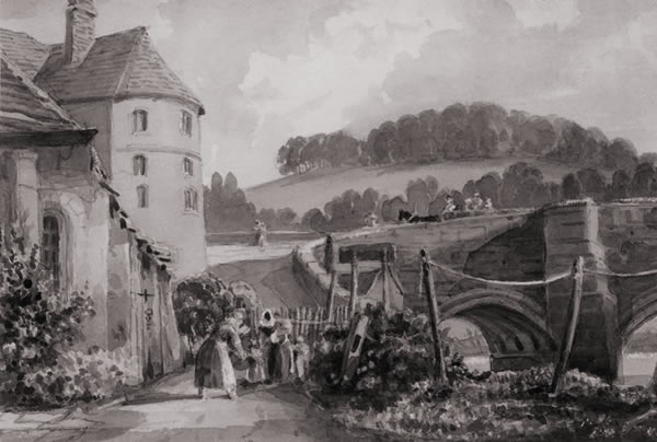 Old Trent Bridge – 1844 by John Harden (Winshill end of old bridge)
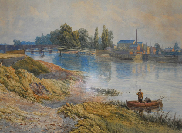 Old Trent Bridge – 1857 by William Wilde (North side, note footbridge and lock gate)
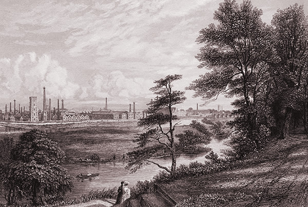 View from Stapenhill- c1870
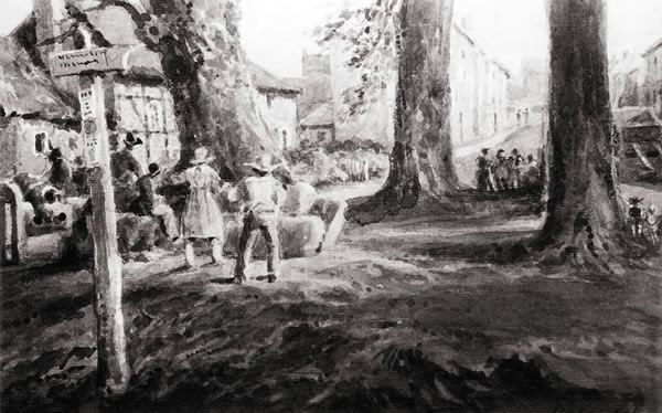 The Triangle, Stapenhill – by John Harden (Saint Peter’s Street)
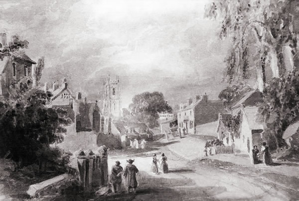 Stapenhill Village – by John Harden (Junction of Hill Street and Main Street)
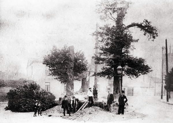 Stapenhill Green – by John Harden (Tree felling on what is now Saint Peter’s Island)
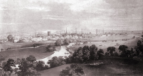 Burton Washlands – 1881 (View from top of the new Saint Peter’s Church tower)
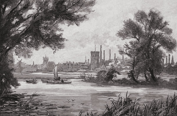 River Trent – 1890s (View from Stapenhill Road)


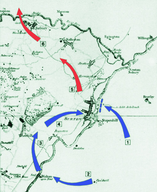
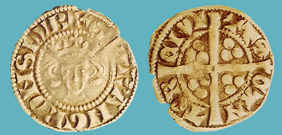
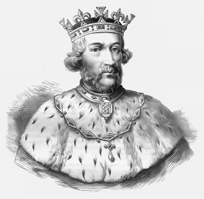 In retaliation, King Edward II (pictured) decided that he would lead an attack against Tutbury Castle and assembled an army in London.