Menu Close

Byrkley Park – Early History

The name Byrkley, which has changed a few times over the centuries, is derived from the family De Berkeley of Berkeley Castle in Gloucestershire. In the 13th century there was a hunting lodge on the site which was in the heart of the ancient Forest of Needwood. Thomas de Berkeley was keeper of the Tutbury ward and occasionally stayed there.

Needwood Chase, as it was then known, had become the hunting preserve of the powerful Norman family de Ferrers, Earls of Derby, whose collective estates were known as the Honour of Tutbury. In 1267 the daughter of William de Ferrers married Thomas de Berkeley.

Because the Ferrers allied themselves with Simon de Montford in his rebellion against Henry 111 they were forced to forfeit their extensive estates to the crown. These subsequently became part of the Duchy of Lancaster which passed to the crown again in 1399.

Those were bloody times but Byrkley Lodge saw the coming and going of generations of monarchs, of charters and changing laws, was controlled by numerous keepers and saw the births, marriages and deaths of numerous tenants.

The hunting lodge was usually the residence of the keeper who was appointed by the King. It was also used on occasions by the monarch on hunting expeditions. Edward IV, who was a particularly keen huntsman, spent lavishly on extensions and repairs. Byrkley Lodge alternated with Tutbury Castle at one time as a venue for the wood mote or forest court. At such times miscreants would be brought before officials who would levy fines for trespass, poaching and other forest offences.

King James I often visited his much loved lodge at Byrkley. The ‘Woodmote Court’ was the only local judicial body. On 19 May 1337 the Chief Forester (Judge) dealt with the following cases:

– A person of Tatenhill fined 2 shillings for stealing three tops of fallen oak trees near Byrkley fishpond.
– Robert Clerk fined 12 pennies for taking one oak tree top from Dunstall Hill.
– Robert Dicon fined 6 pennies for cutting down lime trees.
– Richard Merriot fined 6 pennies for trespassing two colts in the lord’s fenced Byrkley Park.
– The Rector of Tatenhill Church fined 12 pennies for trespassing 140 sheep in Byrkley Park.
– Henry Brown fined 3 pennies for breaking down park palings in Highlands Park half a mile from Byrkley.

All offenders were held in the mercy of the court under surety of the Chief Forester.These courts were no longer necessary once the disafforestation of Needwood was affected after the enclosure in 1801. By this time the forest had changed. Once the home of the wolf, wild boar and wild fallow deer, it was now exploited for timber and pasture. On the lush meadows and grassland grazed the stock and dairy herds and the horses of the Earls and manorial lords. Plentiful oaks supplied acorns for pigs, and where oaks and timber trees were felled underwood and thorn were planted to provide cover for game. Venison, fish from the ponds, and honey from Needwood supplied the Lancastrian households and provided rewards for their supporters and officials.

In 1754 Lord Townshend, whose wife Lady Charlotte Compton had inherited Tamworth Castle and succeeded to the Ferrers barony, acquired the leasehold of Byrkley Lodge as his hunting seat. Here he built a house more extensive and somewhat more elegant than the earlier lodge, where they could retire in peace for a few months of the year.

It had become fashionable in the early 18th century to seek quiet, for some even solitude, in a country retreat, and Byrkley Lodge was ideally situated. Needwood Forest became the haunt of poets, philosophers and painters in search of the picturesque, as well as those in pursuit of the regular sporting pleasures of the forest.

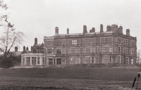
Byrkley Lodge

The residents of Byrkley Lodge, like those at Yoxall Lodge lying little more than a mile south on Linbrook, found the natural brook, the valleys and plains, the fertile soils and the picturesque gnarled oaks all lent themselves well to the designs of landscape gardeners. Before he sold Yoxall Lodge to John Gisborne in the mid 18th century Sir Nathaniel Curzon had Ernes, a landscape gardener following the tradition of ‘Capability’ Brown, design improvements for the grounds there. Brown himself was planning the complete rebuilding and landscaping of Fisherwick for the Marquis of Donegal. The Marquis purchased Byrkley Lodge from Lord Townshend and the watercolours of the house and grounds in 1786 show clearly the influence of these gardeners who blended their cultivated art with nature.

On a 1775 map to the nobility Byrkley Lodge is the only building in the wooded area of the Needwood Forest Plateau except for Yoxall Lodge. Its only neighbour at this time was Hanbury Park Farm some 3 miles north.

The inhabitants of many of the great houses in the vicinity were closely associated by ties of friendship and marriage. They shared enthusiasm for hunting and fishing, archery and battledore, books and poetry, music and painting, and exchanged ideas on gardening developments. Many interesting figures of this period found pleasure in this company: William Wilberforce, Erasmus Darwin, Joseph Wright, Richard Lovell Edgeworth (2 of whose 4 wives were sisters of Edward Sneyd) and the novalist Maria Edgeworth.

Richard Edgeworth had 22 children. Edward Sneyd had only one and Mary Emma Sneyd did not marry. But one of her close friends, one of the 6 sons of Thomas Gisborne of Yoxall Lodge, married the daughter of Michael Bass of Burton-on-Trent. Mary (Bass) Gisborne’s brother, another Michael Bass, eventually rented Byrkley Lodge from Emma Sneyd in 1850.

The deeds of this lease are interesting in the detail of care for the property stipulated by Miss Sneyd. Of particular interest are the gardens and greenhouses mentioned, hothouses, shrubberies and pleasure grounds. Michael Bass had to spend £350 for improvements and reparations and ‘keep the gardens and garden grounds belonging to the Mansion House cropped and manured and managed the same according to the most approved methods of gardening’.
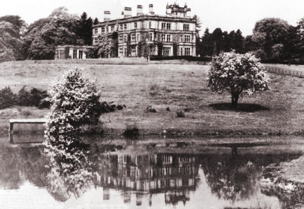
Sir Oswald Mosley wrote in his 1863 ‘Natural History of Tutbury’ that: “At Byrkley Lodge, for some years, families of pure white rabbits have been produced in the park where they make a very striking appearance”.

Before the Bass family rebuilt the Lodge, previous occupants had tried to make Byrkley different. Albino rabbits were bred and released in large numbers into the grounds. Byrkley Park was the only country estate in existence to have true white rabbits running wild. When the Bass family lived at the Lodge, workers were not allowed to shoot any of these white rabbits.
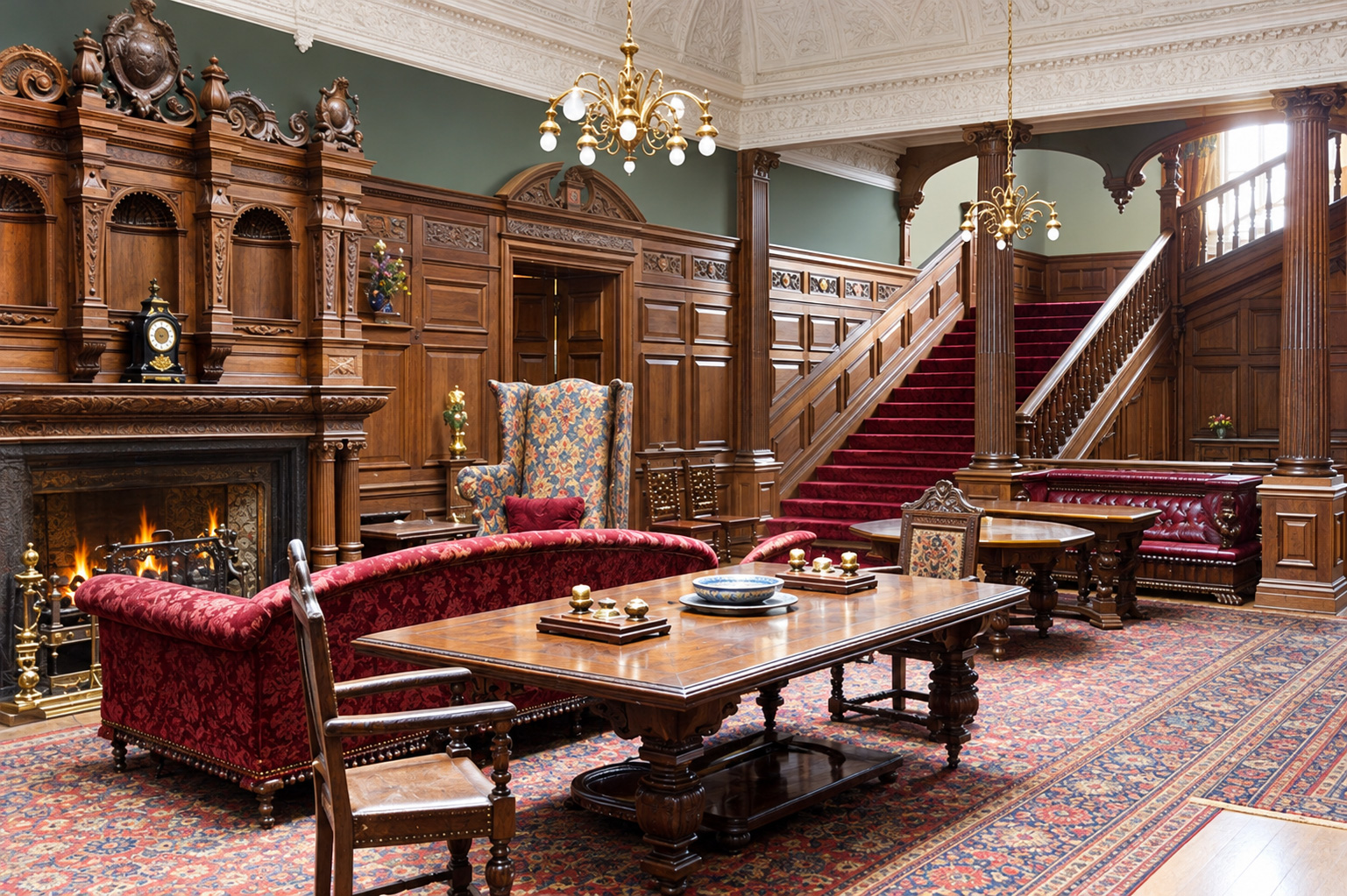
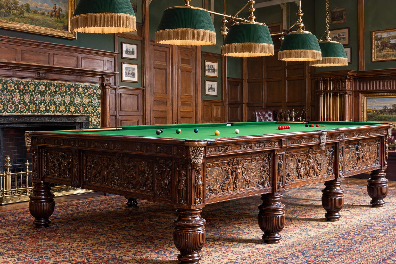
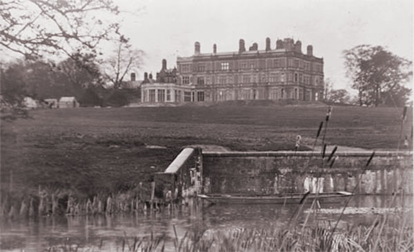
Brykley Lodge was completely re-built between 1887 and 1891 for Hamar Bass.


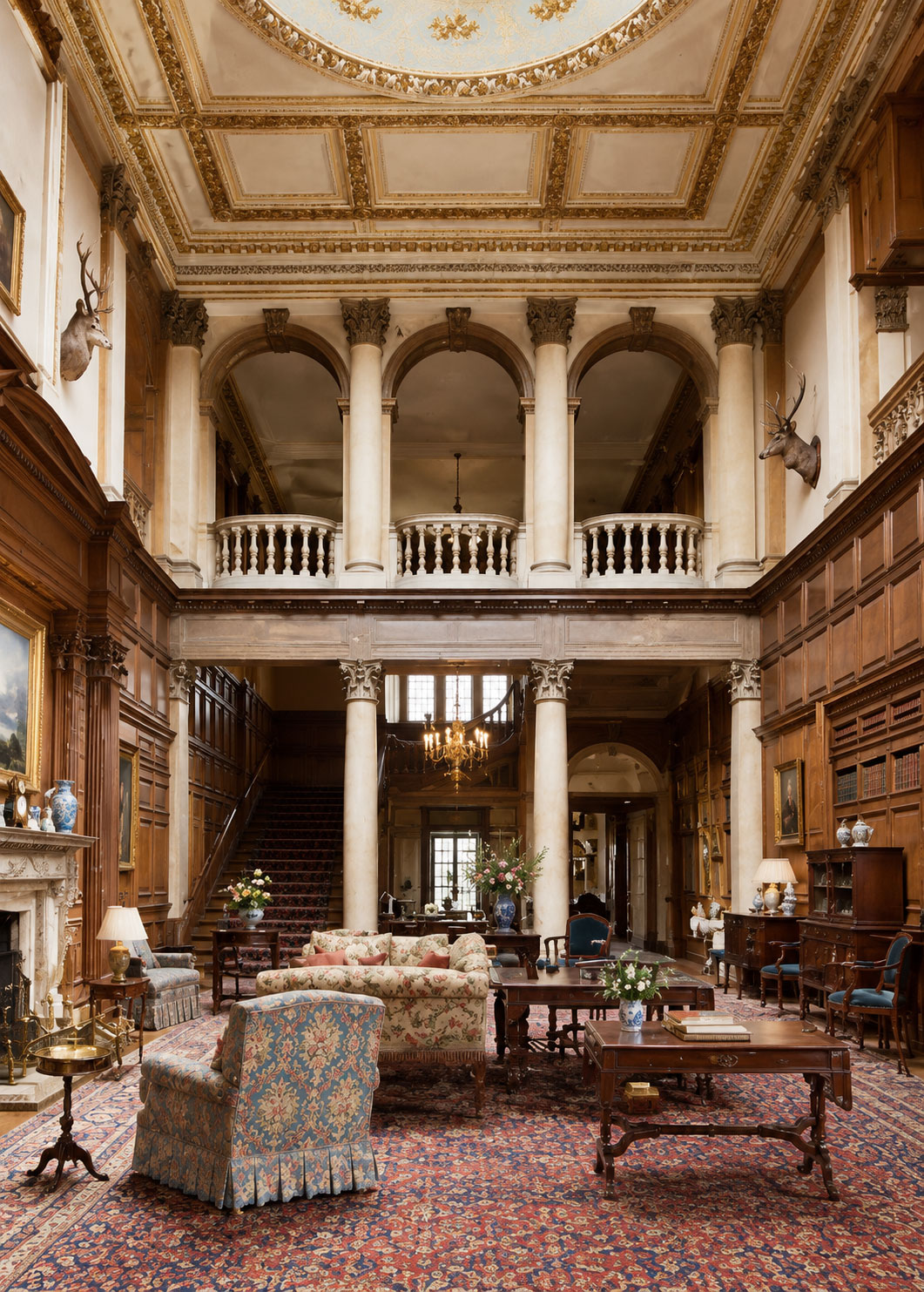
The impressive Entrance Hall and stairway


The Billiard Room with its magnificent billiard table.


A 10 year later view of the entrance hall and impressive stairway after a large renovation.

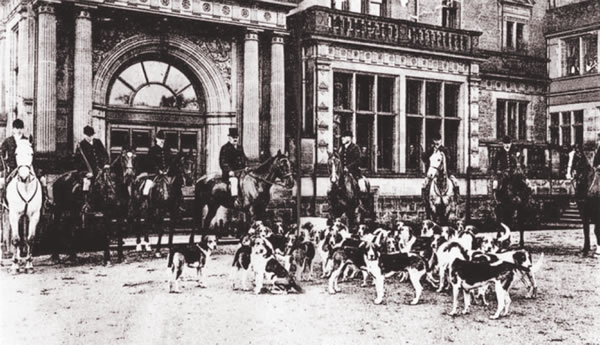
The stables at Byrkley Lodge, which survived for some time after the main house eventually demolished, enjoyed some fame and success. The Byrkley Stud produced ‘Love Wisely’ which won the Ascot Gold Cup in 1896. Hamar Bass was also the master of the Meynell (Fox) Hunt for 12 years so the hunt started at the front of the lodge.

Hamar’s son, William, succeeded in his uncle’s baronetcy according to special remainder and inherited Byrkley Lodge. The great mansion left by Sir William Bass and sold in 1952 was demolished.

Trent Bridge – Early History

The origin of the old bridge on the north side of Burton is not known, but it is certain that for a long time it ranked amongst the wonders of the land. In the early records of the Abbey there is reference made to a sum of money being set apart for the bridge, but this is thought to be for the repairing of it, not for the building.

There seems to have been a bridge of sorts on the site before the Abbey was established in 1004 AD. For many years after the Abbey was built, High Street, then called Old Street and later Long Street, consisting of very little beside two sloping banks and a ditch between them. There was little else to Burton aside from the Abbey. Some antiquarians even claim that the bridge is over two thousand years old, and that the Icknield Road, stretching from Derby to Ashby, must have crossed it. If that be true, it gives much credit to Roman building skill and materials.

There was certainly a substancial bridge on the site by the early 12th century. A bridge keeper was recorded as holding land on the Winshill side. It is not certain whether it fully spanned the river at this time but it certainly did by the end of the 12th century by which time, burgage plots were established in Horninglow Street, ‘west of the great bridge’. It was probably built of stone, or at least had stone footings, although the first surviving mention of a stone bridge is from 1322. The exact form of the structure is unknown but providing that it was not later substantially altered it would have been as described in the 18th century: running north from Winshill before turning west across the river and the west arm, the bridge was then 515 yards long and 15 feet wide and had 36 arches. By the 1590s water no longer passed through two of the arches where land had silted up at the south end of Burton meadow, creating Umpler green. The east end of the bridge was widened in 1831, and in 1839 the first two arches on that side were filled in.

The west end of the bridge originally terminated with a causeway on the south side of which cottages had been built by 1550. In 1835 there were three houses there and four on the north side. The causeway was raised in the later 1750s, after the road had been turnpiked, and two low arches were inserted as culverts.

Grants of land and bequests of money for the upkeep of the bridge are recorded occasionally in the Middle Ages, and in 1546 the endowment comprised three houses and a small amount of land and meadow, worth 21s 4d a year. The abbey seems to have taken no formal responsibility for maintaining the bridge and much of the money needed for repairs came from alms, presumably collected by a chaplain who maintained a bridge chapel. When part of the bridge was swept away by flood in 1284 John of Norfolk, who was acting as keeper of the works of the bridge, was given royal protection to beg for alms to repair it, as was the keeper in 1324. A grant of pontage made in 1383 was to a body of trustees, including a chaplain who may have been the bridge keeper. John of Norfolk, described as a ‘monk’ in the royal grant of 1284, and a ‘bridge monk’ recorded in 1396 are unlikely to have been monks of Burton abbey, and were almost certainly lay hermits, possibly following the rule of St. Paul: a house called the Hermitage in 1546 stood at the west end of the bridge on its north side, opposite the chapel.

In 1441 the abbot and leading townsmen appointed a layman as keeper and proctor of the bridge for a 30 year term, and a layman was appointed for life in 1493. In 1527 an appeal for funds was launched by the abbot, the prior of Tutbury, George, Lord Hastings, and local gentry.

Some of the £20 a year that Burton college was obliged, probably from its establishment in 1541, to spend on making and repairing roads may have been applied to the upkeep of the bridge. At its dissolution in 1545 the college was paying 33s. 4d. a year to a bridge master named William Mason (or Edge), who seems to have been a stone mason retained originally by the abbey; he was still paid a fee by the Paget family in the later 1560s. The annual cost to the manor of maintaining the bridge was estimated at £16 13s. 4d. in 1585. The Pagets evidently assumed responsibility for the bridge, and the obligation was specifically included in the Crown’s grant to William Paget of his father’s forfeited estates in 1597. The cost of repairs was a constant drain on the manor in the 17th and 18th centuries, and when the road over the bridge was turnpiked in 1753 the earl of Uxbridge was awarded £20 a year from the tolls for bridge repair. It remained the lord’s responsibility until 1864.

Bridge Chapel
There was a bridge chapel by the 1260s, and its dedication to St. James was recorded in 1332. On the eve of the Reformation services were being celebrated there by the town’s guild priests. The chapel stood at the south-west end of the bridge and had a south door onto Burton hay. There was also a cross at the east (now Winshill) end of the bridge in 1598. The chapel, having fallen into disrepair, was demolished in 1777.

1322 Battle of Burton Bridge

The 10th March, 1322 was not a great for Burton; it came under heavy attack and much of it was destroyed. Even so, it is quite an exciting thought that the invasion troops were led by the King Edward II of England himself and of him riding into Burton on his charger.

The story starts with Thomas Plantaganet, earl of Lancaster (1278-1322), who was the grandson of King Henry III. After marrying Alice, daughter and heiress of the Earl of Lincoln, the earldom of Derby was added to those he already owned and with it came Tutbury Castle.

Thomas didn’t much like his cousin Edward II and felt that he would make a much better King himself. He became one of the leaders of the baronial opposition to the King; he also sided with the Scots against him. This was confirmed to the King when Robert Bruce ravaged the north of England but the Earl of Lancaster’s lands were among those spared.

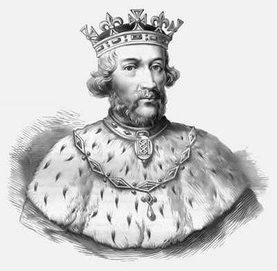
In retaliation, King Edward II (pictured) decided that he would lead an attack against Tutbury Castle and assembled an army in London.
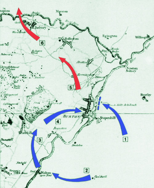
Hearing of this, Thomas returned to Tutbury with his own army of 30,000 men. Knowing that Burton Bridge was the only crossing over the river Trent for many miles in either direction and therefore sure to be the route taken by the King, he put much of his defensive effort into fortifying it on the Burton side. The King however, received the advice that there was a little known passable ford at Walton a few miles upstream. He therefore sent a decoy force to look as large as possible while the main body of soldiers crossed at Walton to lauch an attack on Burton from the direction of Branston.

Thomas was caught by surprise and was heavily defeated at the Battle of Burton Bridge on 10th March, 1322 and retreated to Tutbury Castle, leaving most of Burton in flames. Tutbury Castle was later looted and damaged but not destroyed.

Thomas was expecting reinforcements from his Scottish allies to join him at Tutbury but they didn’t show up so he was forced to escape over the Dove and flee north back to his seat and main residence at Pontefract Castle.

On 16 March, Lancaster and his army had reached Boroughbridge by the River Ure. There they were cut off by the forces of Sir Andrew Harclay, a veteran from the Scottish wars, who had gathered the levies from the counties of Cumberland and Westmorland.

With no more than 700 knights and men-at-arms in the rebel army and over 4,000 soldiers in the royal army, Lancaster initially tried to negotiate, but Harclay could not be swayed. The ‘Battle of Boroughbridge’ ensued but the battle was short and one-sided.

The captured earl of Lancaster was escorted back to Pontefract where he was condemned to death as a traitor and beheaded by sword in front of a jering crowd on 22nd March, 1322, just twelve days after his battle at Burton. This might have been considered a lenient sentence because traitors were more commonly drawn and quartered first!

Battle Map Key:
1: On the 5th/6th of March, 1322, the first royal troops build up and attack of the bridge which was successfully repulsed. Edward II arrived in person via Cauldwell on 10-11 March.

2, 3, 4: Learning of the crossing at Walton, a diversory force was left to appear as large as possible while the main force, including Edward II, crosses at Walton to attack Burton from the West.

5: The surprised earl of Lancaster’s troops set fire to as much of the Burton as they can before fleeing North.

6: Lancaster’s troops cross the river Dove retreating back towards Pontefact, losing or hiding a chest reputedly containing a large proportion of 300,000 coins intented to pay the army.

The unfortunate Burton was left sacked, requiring it to be almost completely re-built.

Thomas was remembered as a defender of popular liberties and buried in a tomb at Pontefract. There was also an effigy of him in St Paul’s Cathedral, London. He left no children and his titles and estates were forfeited to the crown but in 1323, his younger brother, Henry Plantaganet, successfully petitioned to take over the earldom of Leicester.
King Edward II was deposed and murdered in 1327 (although modern history favours that this was a ‘fake death’). Regardless, the throne was passed to his son, Edward III, who wrote to the pope numerous times requesting the canonisation of Thomas but this was rejected.

After Edward II’s death, Edward III’s parliament posthumously reversed Thomas’s conviction so Henry Plantagenet  took possession of the Earldoms of Lancaster, Derby, Salisbury and Lincoln making him the new owner of, among many things, Tutbury Castle.

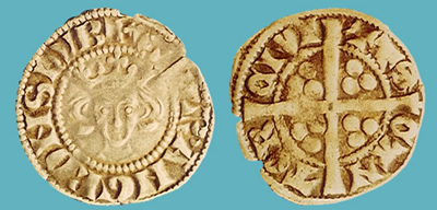
A large hoard of gold and silver coins hidden in three small barrels was discovered by workmen in 1831, the equivalent of well over £250,000 today, is thought to have been the payment from the Earl to his troops and Scottish allies, hidden in the bank of the river Dove as he fled for Pontefract where they remained undiscovered for over 500 years. The above example coin was one of the newest and depicts Edward II’s father King Edward ‘Longshanks’ I.

1643 Battle of Burton Bridge

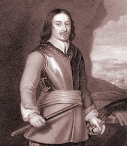
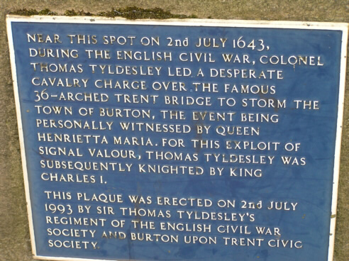
In 1643, during the English Civil War, Burton Bridge was the scene of what is probably the most famous local battle; ‘The Battle of the Bridge’. Thomas Tyldesley, a supporter of Charles I and a Royalist commander at the time having the rank of Colonel, led a cavalry charge across the bridge to attack Burton, which had become a Roundhead stronghold.

The event is reported to have been witnessed by Queen Henrietta Maria, wife of Charles I. It is largely because of the success of this attack against the odds that Thomas Tyldesley (above) was knighted. A plaque to commemorate the event was erected on the replacement bridge by the Burton Civic Society in 1993. It is still there today but goes largely unnoticed.

The bridge was also documented to be the site of a battle in 1322, between Thomas Plantagenet, Earl of Lancaster, who owned among other things Tutbury Castle, and the forces of Kind Edward II.

The medieval bridge, described by Robert Plot in the 1680s as ‘the most noteworthy example of civil building in Staffordshire, or perhaps even, the whole of England’. By 1790 this had changed to ‘a bridge of not very stately appearance’. There was no footpath, but at every buttress of the wall there was a recess to provide a passing place which was becoming an increasing problem.

Old Trent Bridge

The Nineteenth Century


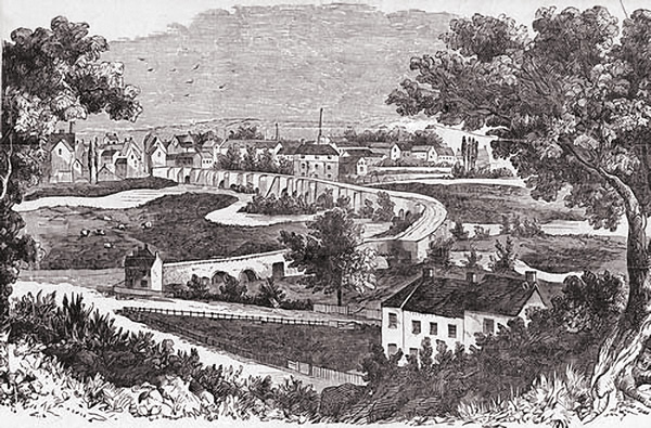
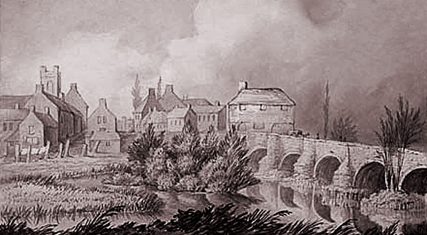
The first picture has made its way into many publications and, though a pictorial representation from 1800, it has proved to be a useful recourse in tracing the course of the old bridge, famous in its heyday for its thirty-six arches. The course of the river can also be seen to have changed quite a lot since this time.


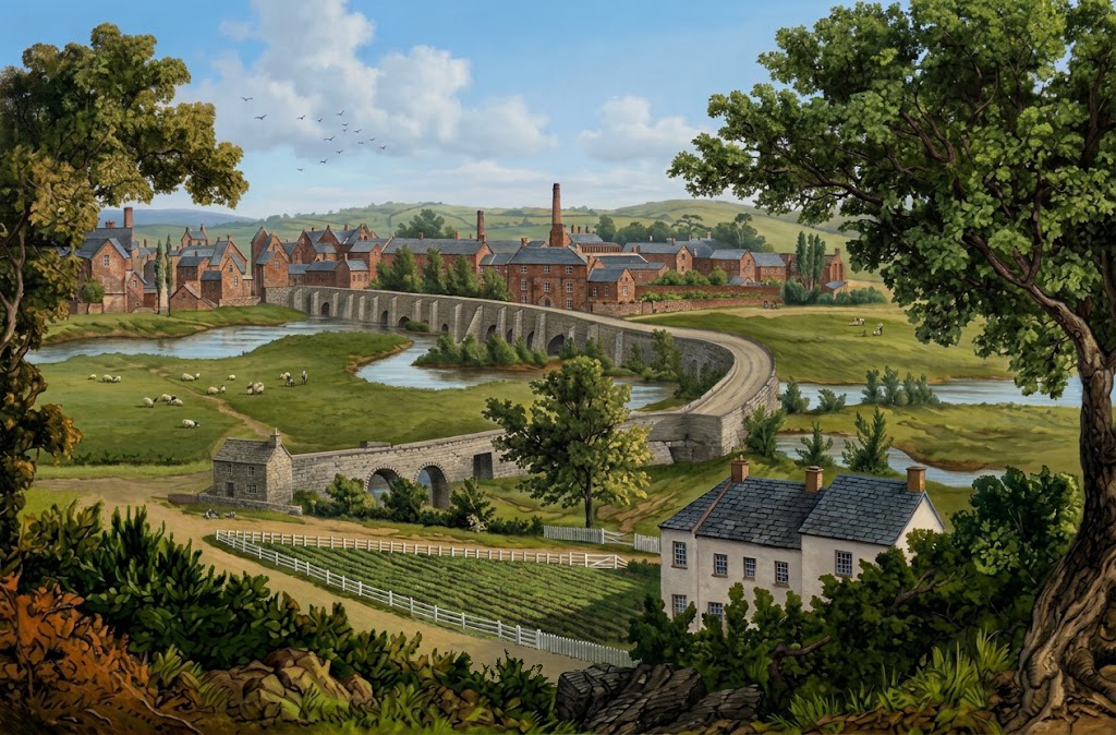
And my first generation restoration based on the image.

The above painting of them Old Trent Bridge was painted in 1840 and, although anonymous, provides an excellent insight. Most of what is there can be authenticated so it seems to offer a fairly accurate picture of how the bridge appeared at the time viewed from the Stapenhill end.

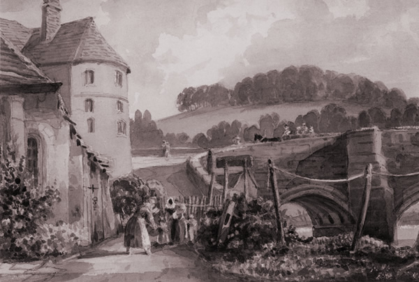
The above image shows the painting ‘Burton Bridge’ by John Harden (1772-1847). Although quite a lot of artistic license has been applied with, for example, Scalpcliffe hill being completely relocated and wooded, the fact that it is accurately dated as 1844 makes it a nice inclusion here.

The above 1857 painting of Burton Bridge by William Wilde, though not very detailed, illuminates a couple of very interesting features. Firstly, the separate footbridge, and secondly, the lock gate with a few boats in a key on the other side.

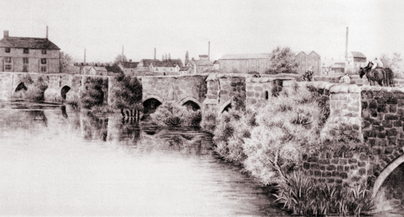
The above is one of the most illustrative paintings of the ‘old’ Burton Bridge.


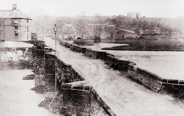
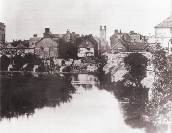
The above image shows an excellent view of the Old Trent Bridge and is based on one of the earliest surviving actual photographs. The recently completed Bladon House built for John Gretton stands proudly on the top of the hill.

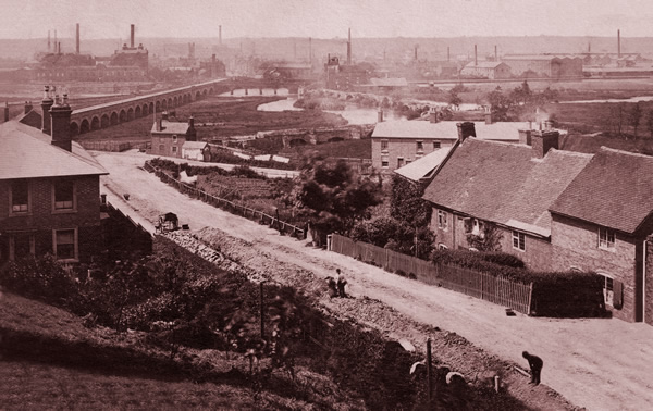
And below, two later images that show how industry is beginning to grow.


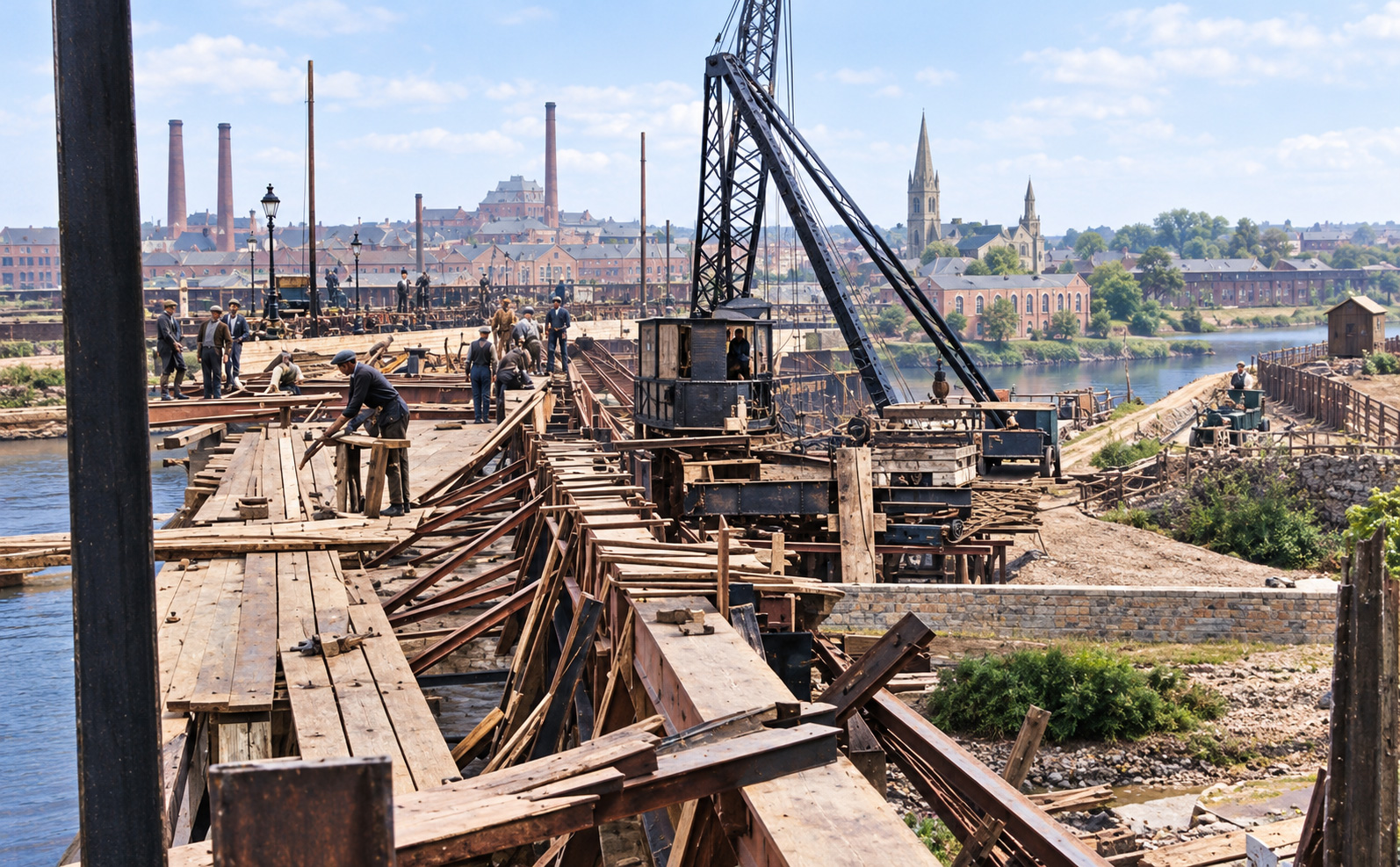
Above shows the commencement of the new replacement bridge in 1863. The foundation stone close to the initial site, which can just be made out on the left, was laid by Mr John Richardson, the High Bailiff of Burton. To the right is the old bridge still in use In-between is Bridge Steet with building which still exist.

Finally, a remarkable photo capturing the brief period when both Trent Bridges co-existed. The newly finished straight bridge can be seen in its familiar place, although only 40 feet wide before being later widened to twice its width.  On the north side, to its right in the photo, the old bridge with its much less direct course can still be seen before it was finally demolished.

New Trent Bridge (1864)

A new bridge was under consideration in 1840 but it is not until 1853 that plans were finally submitted by the county surveyor, James Trubshaw, who described the existing bridge as enjoying ‘the threefold distinction of being the longest, the most ancient, and the most inconvenient structure of its kind in the United Kingdom’. Nothing was done until 1859 when the Midland Railway Company, which wanted to lay tracks across the west end of the bridge, promoted an Act which authorised its demolition and the construction of a new bridge, forming a straight line between the existing ends and straddling Broad Holme. The medieval bridge was gradually dismantled after the new bridge was opened in 1864.

Designed by the Midland Railway Company engineer, J.S.Crossely, the 1864 bridge was paid for by the Marquis of Anglesey, as lord of Burton manor, and the Midland and other railway companies. Under the 1859 Act responsibility for its maintenance passed from the Marquis to the counties of Staffordshire and Derbyshire, and it remained their joint responsibility until the Derbyshire side of the river was transferred to Staffordshire in 1894. The burden later passed to Burton corporation under an Act of 1896.

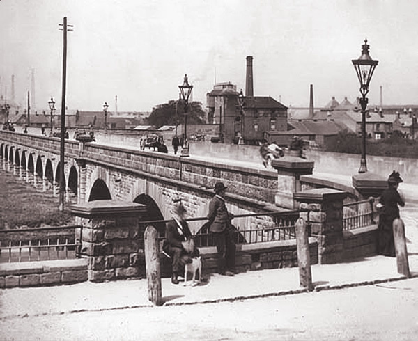
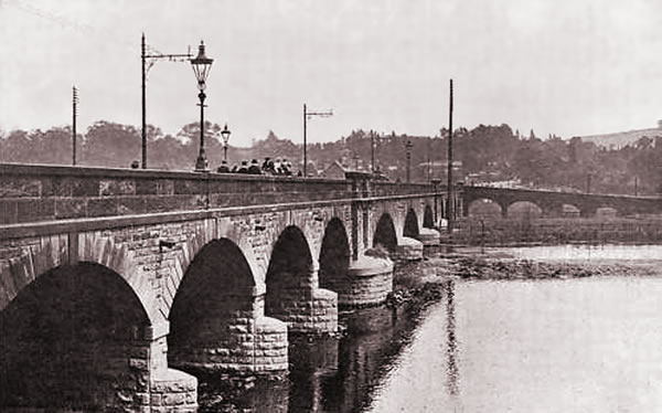
On the 23rd of February, 1863, the foundation stone of our present Trent Bridge was laid, and on the 22nd of June, 1864, a general holiday was proclaimed and the opening ceremony was performed by the Marquis of Anglesey at the head of a long and imposing procession, consisting of the yeomanry, the volunteers, principal inhabitants of the town, followed by many others. The bridge, unlike its predecessor, ran in a straight line across the river. It is 460 yards long, and consists of two causeways each five feet wide, and a roadway 20 feet wide. Each side of the bridge has a wall 3 feet high. There are 29 arches.

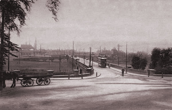
The next two images show the Trent Bridge in its 1864 year of completion. The first gives an impression on how impressive the structure would have appeared, especially from the not yet developed Bearwood Hill and Newton Road.
The second shows someone taking advantage of the photo opportunity.

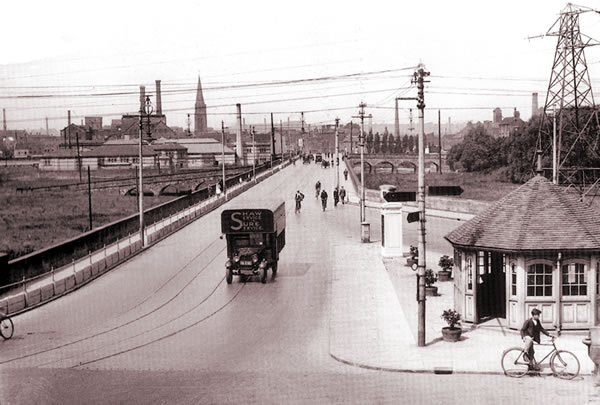
Originally 40 feet wide, including footways of five feet on either side of the road. The bridge was widened on its north side; this was completed in 1926.

The bridge as shown above, shows Burton before the arrival of the tramway system. This photograph is also taken a few years before the Ferry Bridge was built making it the only option to the Stapenhill Ferry for crossing the river.

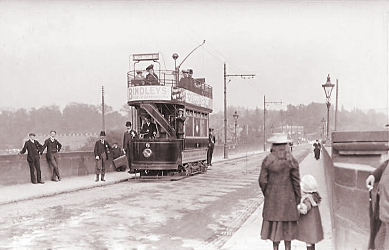
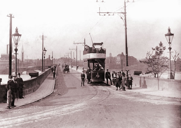
The trams arrived, making for this proud posed photo which later became the subject of a Burton postcard.

Notice that there is only one set of tracks. Winshill and Stapenhill trams had to co-ordinate in both directions so as not to end up in an embarassing head-to-head.

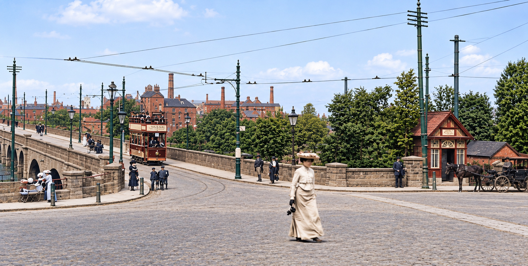
The above photo from 1908 shows what a tranquil place the ‘Swan Junction’ could be.

The tram is clearly approaching, but will it suddenly veer for Stapenhill or Winshill?

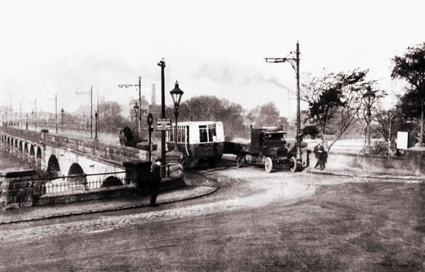
Before the bridge was widened and with the trams still in service, the increasing variety of modes of transport added to the confusion.

… and the bridge still remained much used by pedestrians.

Trent Bridge Widening 1926
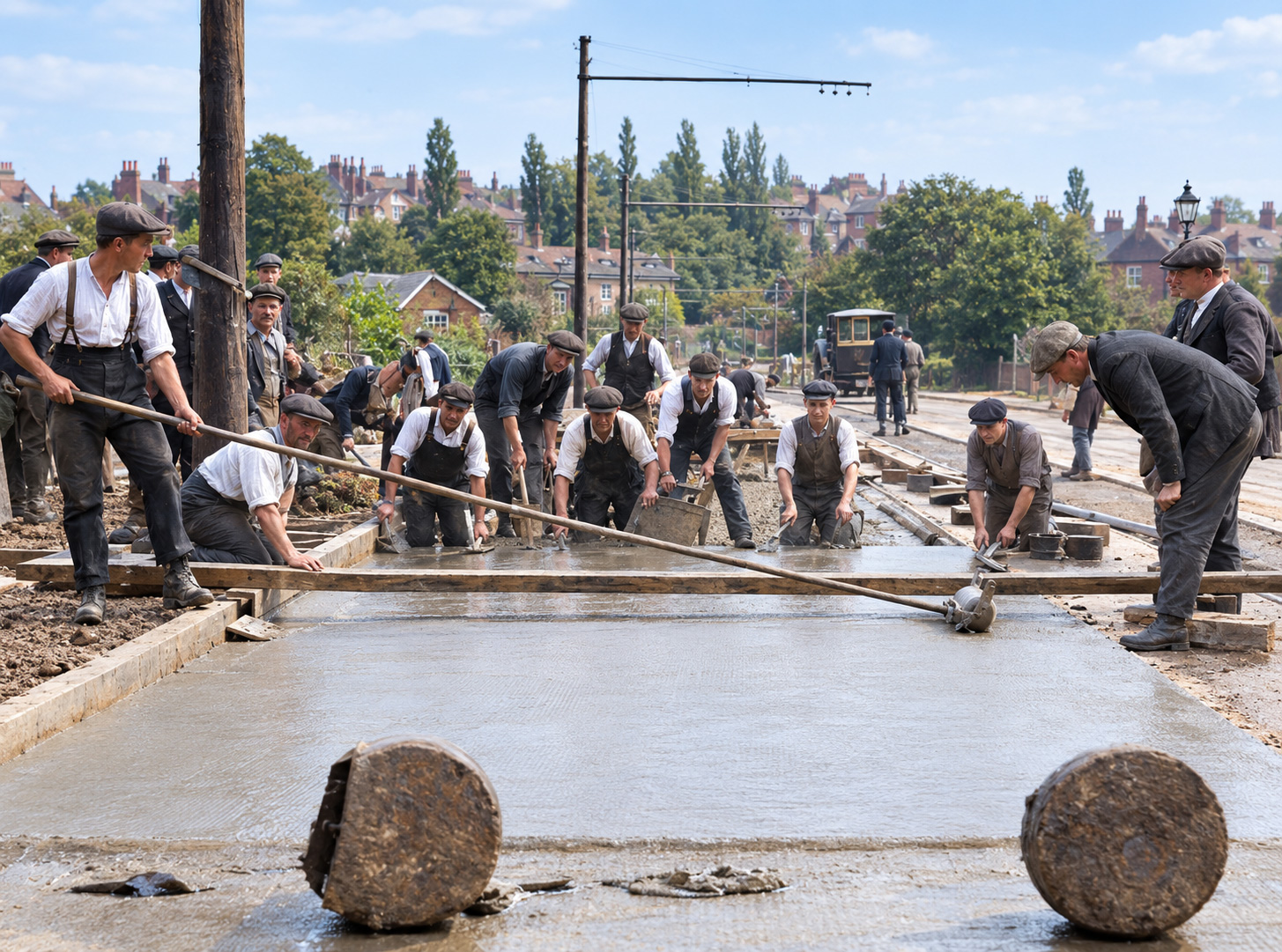
If, like many, you marvel at the foresight of it being built large enough to accommodate today’s traffic, you may be disappointed to learn that it was originally less than half its current width and had to be widened to cope in 1926. The tramway that used to traverse it only had a single track to handle both directions of Stapenhill and Winshill tramlines as well as the Burton and Ashby Light Railway trams so it had become something of a bottleneck.

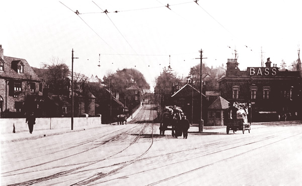
The above photo shows the view from the bridge looking up Bearwood Hill in 1910

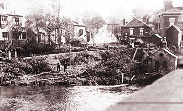
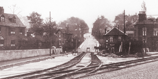
Following a serious tram accident in 1919 where a tramcar ran out of control down Bearwood Hill over-turned after being de-railed at the sharp corner at the bottom, the Winshill end of the Trent Bridge was modified to provide a straight run.

For many years, Bearwood Hill up into Winshill felt like an extension of the bridge.

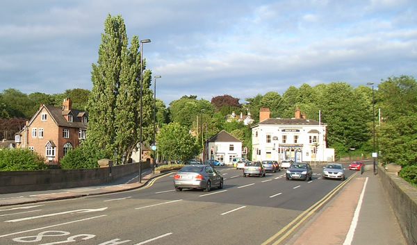
The widening is simply taken for granted now as today’s traffic simply flows into the Winshill filter lane. Trees and pedestrian area now effectively break up the view up Bearwood Hill making it feel like a much more minor route.

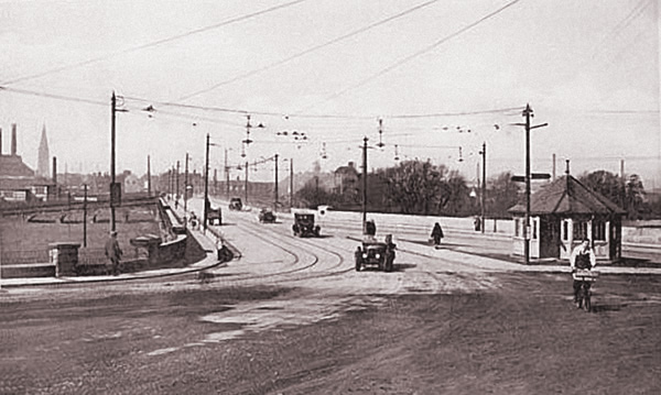
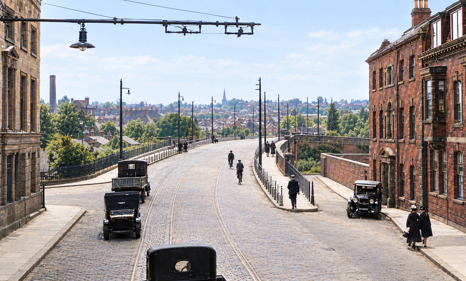
From bicycle delivery boy to boy racers in ‘modern’ sports cars – everyone enjoyed the space just after the widening. Some must have questioned whether it was really necessary.

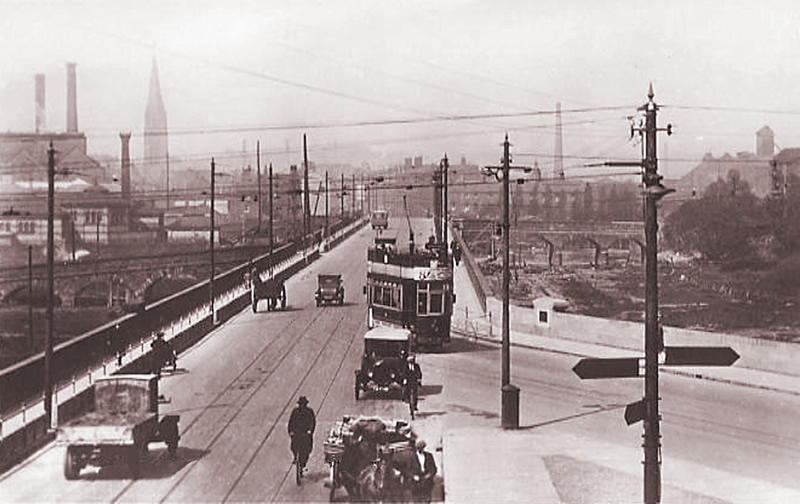
As time went on, it got busier and can be seen here being shared by bicycles, hand carts, horse drawn cars, motor cars, early lorries and electric trams.

Note also, the substantial barriers to protect foot pedestrians from such a commotion.


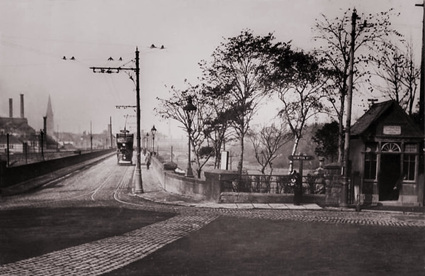
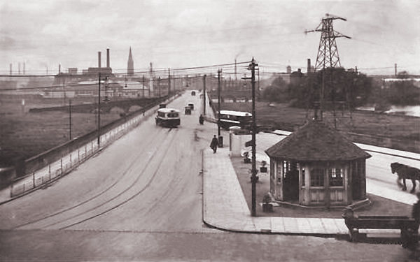
Even I can just about remember the distinctive shelter as a boy, and on rainy days, timing a dart across the road to catch an approaching number 3 or 4 bus up into Winshill, although everything around it was a little different. The overall impression is that this end of the Trent Bridge used to me much wider than currently which of course, it can’t have been.

By far the majority of photos of the Trent bridge are taken at the more picturesque Winshill end. Below is a much rarer photo from the Bridge Street end in taken in 1928 in the short period between the widening of the bridge in 1926 and closure of the Tramway system in 1929. It is still a very recognisable view.


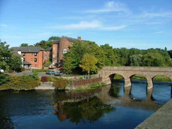
The bridge remains one of Burton’s most characteristic features.

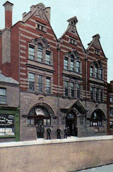
Burton General Post Office

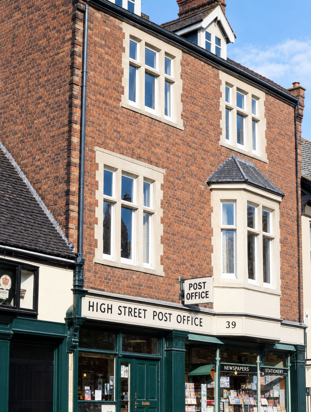
The first recorded Burton postmark was in 1722 although the nearest sorting office was in Lichfield. Burton would not get its own until Post Office for well over another hundred years! The first Post Office was established at 39 High Street.

The first public telephone service available in Burton was 1895 when the National Telephone Company speculatively rented a shop in New Street. The National Telephone Company was eventually absorbed by the GPO and the combined exchange finally moved into new premises in New Street in 1905, built by R.Kershaw Limited which, just two years earlier, had built the Fire Station across the road.

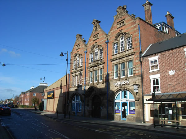
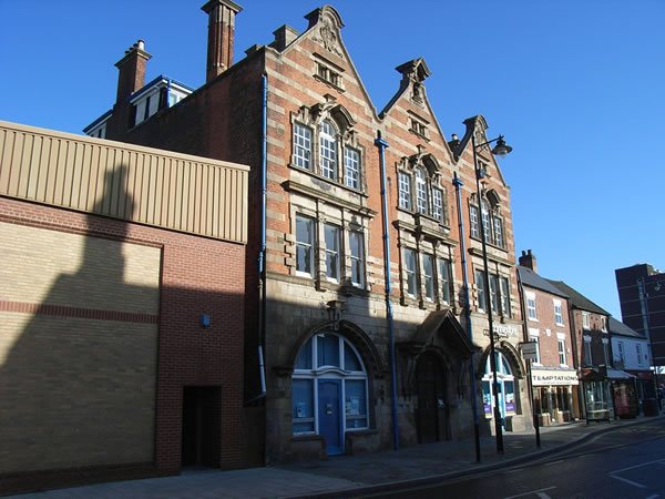
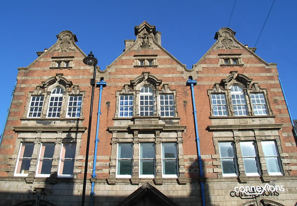
The 1905 building still survives but has struggled to find modern usage.

Postal Service History

The first recorded Burton postmark was 8th October 1722. It arrived at its destination in London two days later. The postage cost, based on mileage, was sixpence (6d) which the recipient had to pay on delivery.

The postmark appeared as BURTON REF 1, which continued to be used until 1768.

Up until 1765, Burton mail from London only travelled as far as Lichfield where it had to be sorted.

In 1765, a number of Staffordshire Members of Parliament, including the MP for Burton, presented a petition to the General Post Office in London complaining both about the service and the high charges added by Burton postmaster, William Stratham. The London to Lichfield postal charge was 4d, but Mr Stratham applied a 2d charge from Lichfield to Burton which was thought of as very unreasonable. It was customary at the time to reply the same day and a further 1d was charged for the return journey. This meant that Burtonians were paying 3d more for the same service available in Lichfield or Derby. In 1765 therefore, the Post Office conceded and introduced a new sorted bag for Burton, avoiding the excess charge. The new bag however, still had to be collected and returned to Lichfield although postmaster Stratham was allowed an extra £60 a year to provide a man and two horses for both Lichfield and Derby.

Horse delivery continued until the Mail Coach System was introduced in 1796 when Burton at last enjoyed its own direct mail service. The route ran through Lichfield-Burton-Derby-Nottingham-Newark; Newark provided the link to the Great North Road which ran up to Edinburgh. The coaches ran to a tight schedule and postmasters at each office signed for each collection and despatch, recording the time.

The earliest recorded local collection service within Burton was 1816. It did not however, prove to be viable and was fairly short-lived.

The post office in 1818 was at the George Inn in High Street. In 1834 it moved to the Three Queens Inn in Bridge Street but was moved back to High Street in 1841. It still stood next to the George in the later 1850s.

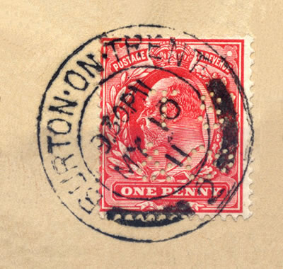
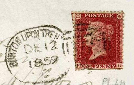
Above shows an 1859 Buron upon Trent postmark and a One Penny stamp of the time. With several collections a day, this was probably being sent to someone else within the town to be read later the same day.

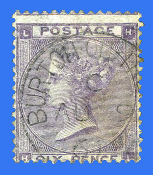
The above stamp, with a Burton postmark dated 9th August 1861, is a Six Penny ‘Lilac’. For half a shilling, this would almost certainly be for a package rather than a letter.

In 1874 the main post office at 162 High Street had Mr Gibson Bowie as Postmaster, William Stone as chief clerk, nine clerks, two stampers, one porter, eight letter carriers and nine rural messangers on the staff. By this time, aside from the main post office, there were ten ‘receiving houses’. These were situated at Newton Road (bottom of Bearwood Hill), Bridge Street, Horninglow Street, Derby Turn, Victoria Cresent, Station Street, Moor Street, Uxbridge Street, Orchard Street and Branston Road.

In 1877 the office was moved to a new building on the site of Parker’s Alms-houses on the east side of High Street which was later to become the Constitutional Club.

In 1905, it moved again to new premises in New Street. These were built by R.Kershaw Limited which, just two years earlier, had built the Fire Station across the road. At the time, there were 12 sub-postoffices in Burton.

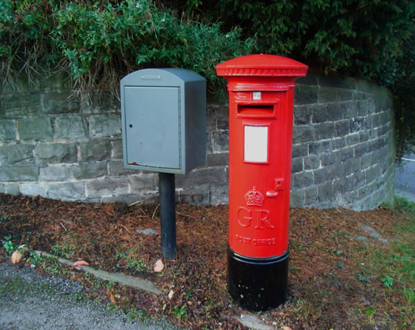
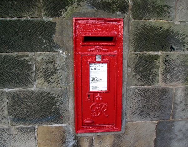
By 1912, there were 19 sub-postoffices distributed around the town but also, a combination of 38 wall and pillar boxes strategically distributed around the town. A few original ones survive characterised by having the Edward VII insignia on the front. Though most of the original sites are still in use, most boxes have been replaced. It was not uncommon for someone to call for the doctor by sending a postcard! Before you scoff however, there were eight collections every day except Sunday, when there were only two. Letters posted in the morning would often reach their local destination before lunchtime and very often, replies were received on the same day. No local post would of course, ever leave Burton unlike todays logistics.


Messenger boys were also available for delivering urgent messages or parcels for which they would receive three farthings.

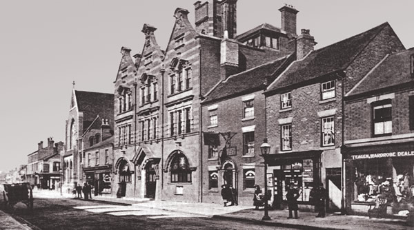
The building can still be seen little changed over 100 years later, alongside some delightful modern architecture (?!).

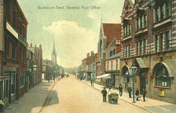
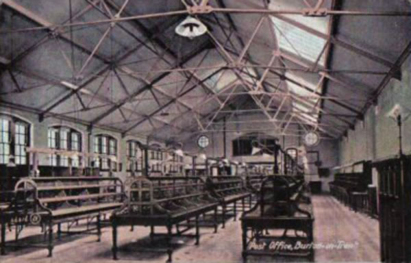
The General Post Office has been the subject of a number of early Burton postcards.


Telephone Service History

There was at the time of course, a much stronger relationship between the postal and telephone services. The first public telephone service available in Burton was 1895 when the National Telephone Company rented a shop in New Street. In 1898, the General Post Office opened an exchange for trunk calls, enabling calls to other towns, when it was still in High Street. The first local telephonist, Miss Clifton, transfered to the Post Office at this time but there was not enough work to have her full-time employed for telephones alone so she also worked as telegraph operator – there were after all, only around 150 telephones in Burton! The annual subscription for a telephone service was £3 3s and calls cost 1d each making them too expensive for the vast majority.

The first telephone system installed in Burton aside from the telephone exchange was incidentally, the Fire Station whilst still in Union Street. Although it is not enormously useful to have the only telephone at least their telephone number was easy to remember; it was ‘1’.

The service was moved to the New Street with the GPO. A few years later, the National Telephone Company was absorbed by the GPO and a combined exchange was opened in New Street across the road from the main post office building.

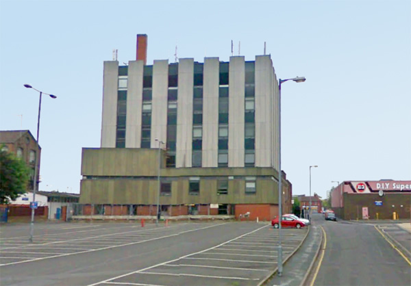
In time, the telephone exchange outgrew the New Street premises and a new large exchange was established in Fleet Street.